New Orleans is a fairly small city, but it’s big enough that getting around town can require some planning.
If you’re staying in the French Quarter, avoid the congestion, potholes and lack of parking by getting around on foot. But if you’re looking to explore more of the city, you’ll need more than your own two feet by making use of the relatively limited public transportation. Here’s everything you need to know about getting around New Orleans.
Slide along in an iconic streetcar
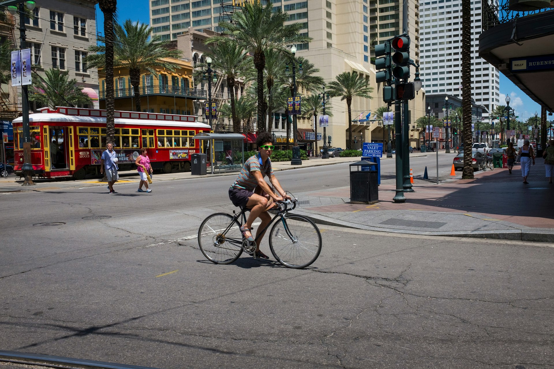
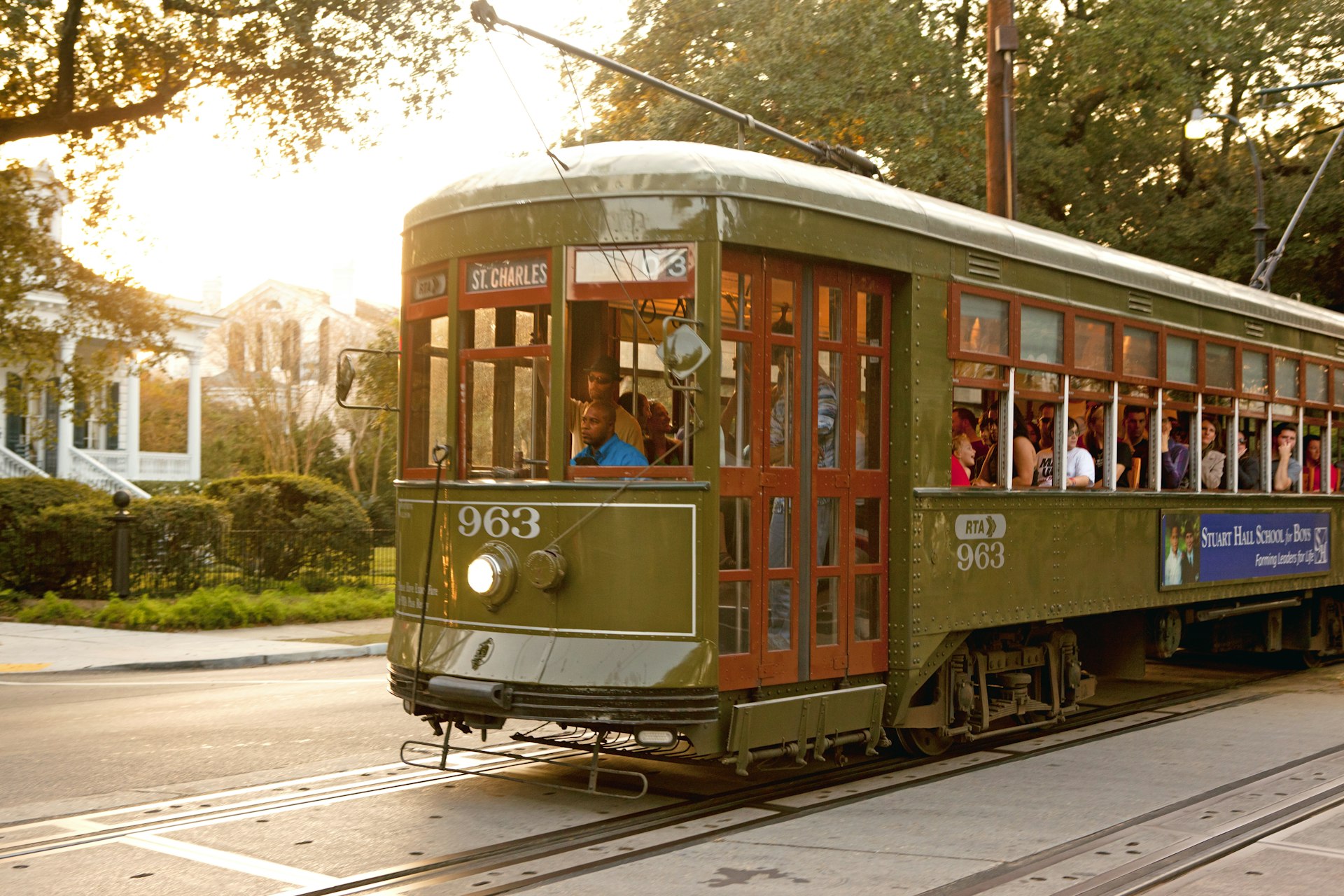
The streetcars of New Orleans sort of sum up Crescent City: beautiful, graceful, antique, old-school, infused with history and romance but not terribly efficient. As a form of transportation you can get around using them, but only certain places. The streetcars cover a lot of tourist-friendly areas, including Canal Street (which runs between the French Quarter and the Central Business District), St Charles Avenue (which cuts through the Garden District and Uptown, including South Carrollton Avenue), the Riverfront Line (which again, runs the edge of the French Quarter) and Rampart Street (which forms the border between the French Quarter and Treme).
It’s worth noting that even with the Rampart, Riverfront and Canal St lines, the French Quarter is not really served by streetcar — these routes form a perimeter outside the Quarter, and you’ll still have to walk to get into the neighborhood. Similarly, the Rampart line follows the curve of the northern boundary of the Marigny (note that the Rampart line also remains closed because of the 2019 collapse of the Hard Rock Hotel; it is hoped it will reopen in 2023, fingers crossed.
The streetcars are not fast, but they do have a clacking air of nostalgia. They’re run by the Regional Transit Authority. Fares cost $1.25; you’ll need exact change if you want to use cash, but you can also use the NORTA app or purchase a Jazzy Pass, good for unlimited rides and usable on buses, too. Streetcars ostensibly run 24 hours a day, but as you might guess, the service gets slower as the night wears on.
Go further on board the bus
New Orleans has a pretty extensive bus system. It’s not the fastest means of getting around, but the buses more or less go everywhere, and they’re inexpensive (same as the streetcar, $1.25). You’ll want to plan ahead, though, if you’re focusing on using the bus as your means of getting around, and be aware that a good chunk of your time will be spent in transit.

Cycling is an option
New Orleans is a funny city for cycling. In general, we recommend it: you’ll have time to gawk at the city’s architecture, and the geography of the city (ie flat and compact) lends itself to bicycle exploration. Plus, there’s a whole fleet of blue bikes in the city’s bike-share program, available for those who want to pedal around. There’s a thriving, economically and racially diverse cycling community here that is enthusiastic about getting around town on two wheels; Nola Social Ride is a great resource for those who want to know about upcoming cycling events or where to find a good rental or repair shop.
The picture isn’t all rosy, though. Potholes abound and although bike lanes are expanding, they’re often taken up by inconsiderate or unaware car drivers. Locals are becoming more accustomed to bicycles, but we still don’t recommend cycling along major streets like Broad, and even St Claude Avenue, which has an established bike lane, can feel dangerous to pedal on, especially at night. And then there’s the weather: New Orleans is humid (often topping 70% humidity) and summer can last, without exaggeration, for six months, so you’ll want to stay hydrated and, especially if you’re coming from somewhere significantly cooler and/or drier, give yourself a day or two to acclimate. Then, consider whether or not you want to arrive at your destination somewhat sweaty.

Soak up the neighborhood vibes on foot
Downtown neighborhoods – like the French Quarter, Faubourg Marigny, Treme and the Bywater, as well as the Garden District and the CBD and Warehouse District – are best explored on foot. You can walk the length of the French Quarter in about 15 to 20 minutes, and less than that in the Marigny. This is a city where casual conversations between neighbors on porches is a time-honored tradition, and you get to really see these knots in the social fabric while walking. Do stick to well-lit roads at night and keep your wits about you; street crime is a reality.
Uptown and Mid-City are physically large neighborhoods broken up by walkable clusters of activity, especially around Magazine Street and Oak Street in Uptown, and Bayou St John and Esplanade Avenue.
Get where you need to go in a car or taxi
Taxis are generally the most practical and budget-friendly means of transportation for getting around New Orleans, and recommended if you’re traveling alone or at night. It’s generally easy to hail a taxi on the street in the French Quarter and other busy areas, but elsewhere you might need call one (there are several cab companies in town, including United Cabs) or use one of the ride-hailing apps.
Renting a car is a good option if you’re planning to be outside the main tourist areas, and, of course, the big plus for renting a car is that when you have your own wheels in New Orleans, you can get outside of town too — day trips to places like the Barataria Preserve become a lot more feasible.
If you do rent a car be aware that the roads here can be pretty bad and parking in the French Quarter is almost inevitably a nightmare and/or expensive — you’ll either have to shell out for a parking garage or look for street parking nearby. If you go with the latter choice, be cautious walking at night and note that on-street parking is typically short-term only; check the meters (one meter often serves an entire block, so don’t assume parking is free just because there’s no meter on the curb immediately beside where you park) as well as the parking signs carefully (street cleaning rules limit parking on certain streets) so that you don’t get a pricy parking ticket. Outside of the Quarter and the CBD, parking is generally not too difficult to find, but again, if you have to walk, remember crime is real. Be wary without being paranoid.
Take the ferry across the Mississippi
The Algiers Ferry runs from the foot of Canal St to Algiers Point, a neighborhood on the Mississippi River’s west bank side, full of wedding-cake cottages and general local cuteness. The Algiers Ferry is a beloved means of commuting for many locals; watching the waters spread out on all sides is humbling and beautiful.
There’s not a lot of accessible transportation in New Orleans
New Orleans is somewhat lax in this department. Sidewalk curbs rarely have ramps, and many historic public buildings and hotels are not equipped to meet the needs of wheelchair users. Modern hotels adhere to standards established by the federal Americans with Disabilities Act by providing ramps, elevators and accessible bathrooms.
Red streetcars on the Canal St, Rampart Riverfront and Loyola-UPT Streetcar lines are accessible to riders with disabilities. Some of the Green streetcars that travel the St Charles Avenue line are accessible.
Regional Transit Authority buses offer a lift service; for information about paratransit service (alternative transportation for those who can’t ride regular buses), call RTA Paratransit. The RTA has also partnered with the nonprofit Lighthouse Louisiana to develop the Assistance Card Program, which benefits riders of public transportation who are blind, deaf-blind or have low vision.
